A Devex event in partnership with Esri
Mapping to strengthen food systems:
Harnessing geospatial data to achieve SDG 2, Zero Hunger
September 21, 2021 — 1 p.m. ET | 7 p.m. CET
WatchAbout the Event
Enough food is produced today to feed everyone on the planet, but hunger is on the rise in some parts of the world and almost 690 million people are going hungry, according to the Food and Agriculture Organization. Detailed geospatial mapping can be an enormous resource in addressing food shortages, improving harvests, and tackling malnutrition. Effective applications of GIS and remote sensing can help maximize agricultural yields through precision farming and the accurate targeting of irrigation and fertilization, as well as monitoring crop health.
Yet the benefits of geospatial data are often out of reach for millions of smallholder farmers in low- and middle-income countries, who play a pivotal role in strengthening the food systems that they and their communities depend on.
On Tuesday, Sept. 21, Devex hosted an ecosystem event on the sidelines of the 76th annual United Nations General Assembly in partnership with Esri, looking at how geospatial data can be used to strengthen evidence-based decision-making to create more resilient food systems that leave no one behind.
The discussion explored how geospatial solutions to food insecurity, malnutrition, and climate change can be sustainably scaled to reach the most vulnerable in our food systems.
The event shined a spotlight on successful applications of geospatial data helping to advance progress on SDG 2 — Zero Hunger — and explore lessons learned and ways the global development community can further scale the use of geospatial technology and leverage the opportunity of the U.N. Food Systems Summit.
This event included live captioning.

Schedule
1:00 p.m. ET
Welcome & introduction by Catherine Cheney, Senior Reporter, Devex
1:05 p.m. ET
Fireside chat: What can geospatial mapping do to tackle hunger?
Speaker:
• Clint Brown, Director, Product Engineering, EsriModerator:• Catherine Cheney, Senior Reporter, Devex
1:15 p.m. ET
Panel Discussion
Speakers:
• Douglas Muchoney, Senior Environment Officer, Head of the Geospatial Unit, FAO
• Sarah Muir, Earth Observation and Climate Analyst, WFP
• Carolina Reynoso Pieters, Country Director, NCBA CLUSA MozambiqueModerator:• Catherine Cheney, Senior Reporter, Devex
1:55 p.m. ET
Closing Remarks by Catherine Cheney, Senior Reporter, Devex
Speakers
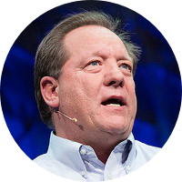
Clint Brown
Director, Product Engineering, Esri
Clint has been at Esri since 1983. During that time, he pursued a passion for GIS-based best practices and guidance that enable our users to make a difference in our world by effectively applying GIS. Through the years, Clint has led these efforts in the role of the Director of Product Engineering at Esri. He established and grew a division of hundreds of applied GIS analysts and practitioners, app developers, cartographers, educators, data scientists, writers, and story tellers – all of whom share a passion for enabling the hundreds of thousands of organizations worldwide to support the effective application of GIS in virtually all aspects of human endeavor. Clint’s teams also work directly with Esri’s ArcGIS Development teams, along with chief software developer Sud Menon, to build and engineer the comprehensive ArcGIS system. In addition, his teams also envision and build Story Maps, the Living Atlas of the World, Learn.ArcGIS.com, guidance on best GIS practices, and most recently the implementation of Community and Collaborative GIS.
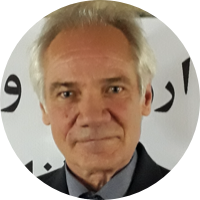
Douglas Muchoney
Senior Environment Officer, Head of the Geospatial Unit, FAO
Douglas Muchoney is the Senior Environment Officer and Head of the Geospatial Unit in the Land and Water Division of the Food and Agriculture Organization of the United Nations (FAO). Prior to this position, he was Chief of Forestry Policy and Resources at FAO Rome and responsible for Climate Change and Resilience, Global Forest Resources Assessment and Forest Resources Management teams. Before coming to FAO, Douglas was Head of the USGS Geographical Analysis and Monitoring Program. Previously, Douglas was a Senior Scientist for Forests, Carbon and Climate in the U.S. Geological Survey in Washington, and served as the U.S. representative to the Global Forest Observations Initiative (GFOI) and Co-Lead of the U.S. SilvaCarbon program. Douglas holds a B.S. in Forestry from Virginia Tech, a M.S. in Geographic and Cartographic Sciences from George Mason University and a Ph.D. in Geography from Boston University.
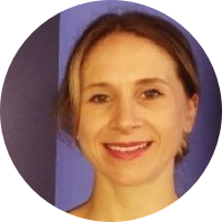
Sarah Muir
Earth Observation and Climate Analyst, WFP
Sarah joined the UN World Food Programme in 2014 after completing her post graduate studies in GIS at Algonquin College, Canada. She is responsible for managing the organization's Asset Impact Monitoring from Space (AIMS) Service. AIMS leverages the power of satellite imagery to evaluate WFP projects constructed or rehabilitated through WFP’s Food Assistance for Assets (FFA) activities, building evidence of the positive impact assets can have on the environment.
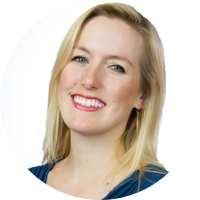
Catherine Cheney
Senior Reporter, Devex
Catherine Cheney is a Senior Reporter for Devex. She covers the West Coast of the U.S., focusing on the role of technology, innovation, and philanthropy in achieving the Sustainable Development Goals. And she frequently represents Devex as a speaker and moderator. Prior to joining Devex, Catherine earned her bachelor’s and master’s degrees from Yale University, worked as a web producer for POLITICO and reporter for World Politics Review, and helped to launch NationSwell. Catherine has reported domestically and internationally for outlets including The Atlantic and the Washington Post. Catherine also works for the Solutions Journalism Network, a non profit that trains and connects reporters to cover responses to problems.
Carolina Reynoso Pieters
Country Director, NCBA CLUSA Mozambique
Carolina Reynoso Pieters is a development professional with more than a decade of designing and implementing programs that promote conservation agriculture, formal land tenure, and increasing market linkages for smallholder farmers. She is currently NCBA CLUSA Mozambique´s Country Director, based in Maputo.

